Rokowhiria

Stories

The team at Rokowhiria produce research and writing for many outlets, including exhibitions, articles, collections, and more. Discover essays, research, and weekly heritage articles, or stay up to date with our latest news.

Tales from the Whakanui Shore

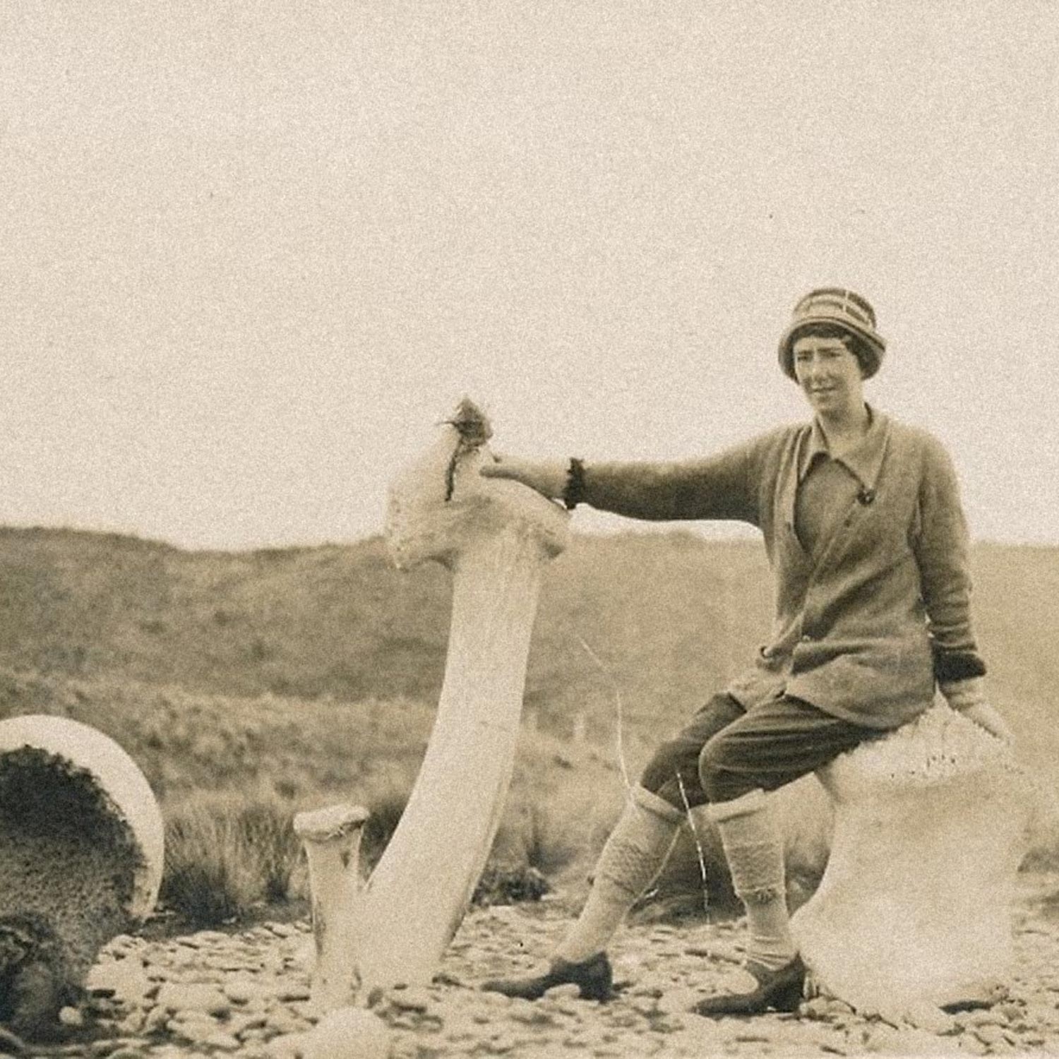
Sepia photograph of Daisy Mackie sitting on the shore at Whakanui beach beside large whale bones, including a tall jawbone standing upright.

If the rugged Whakanui beach could speak, it would have many stories to tell. From the days when tangata whenua traversed the shoreline between the Rangitata and Rakaia rivers, to when a local grocer was apparently robbed by German sailors, there certainly is a lot to discuss about Whakanui beach. Unfortunate whales and visiting seals have laid upon its rocky face, and interesting discoveries have been made over the years which have sometimes left locals with more questions than answers. The mystery vessel On 2 December 1895, it was reported in the Guardian that a mysterious visitor had washed ashore on Whakanui beach. It was not a man, nor a sea-beast, it was something else entirely… an empty fishing boat! The boat had apparently made landfall the previous Friday, 29 November, its origin unknown. It was a flat-bottomed fisherman’s boat, also known as a coble, which was found stranded by two brothers who were out for a stroll. The brothers, named A. and W. Jamieson, harnessed the help of some employees of a Mr. Isaac Thompson, who harnessed the fifteen-foot long vessel to a horse and had it hauled into a gully for safety. Just over two weeks later, on 18 December, there was another report in the Guardian which read as follows: “Some time ago a boat was found on the Wakanui beach and pulled ashore above high water mark. We learn from the police that an officer of the Customs Department was in town yesterday, and made enquiries, the result of which will be probably that within a month the boat will be sold ‘for the benefit of whom it may concern.’” No further mention of the mystery coble seems to have been made in the newspaper, and so we may never know the identity of the runaway boat’s absent owner… Message in a bottle The matter of a poorly-executed hoax, in the form of a message in a bottle, was the subject of a column in the Guardian which was published on 14 February 1891: “Some witling or other a few days ago put a scrap of newspaper in a bottle and left it on the Wakanui beach. On the paper he had written – ‘The ship Kakanui, Captain Best, lost in a gale on the Auckland Islands. This is to let any one know where we are, 3 saved.’ But the clever writer made the mistake of leaving just enough of the print of the Ashburton Guardian, on the margin of which he wrote to enable us to trace the issue, which is that of the 7th February, and the vessel was missing before that date. We circulate pretty widely, but scarcely so widely as all that.” The war comes to Whakanui An event which would soon become a widely-known Mid Canterbury legend was the alleged robbery of Mr. L. C. Turner’s grocery van by German sailors, which occurred on 2 October 1939. The Second World War had been raging for only a month when Turner, who was driving his grocery delivery van near Whakanui beach, was held up and robbed by a group of mystery men who were dressed like sailors. At least one of the men was armed with a revolver. They spoke “with a strong foreign accent”, and in “very broken English” according to claims Turner made to the Guardian. Turner was held at gunpoint while the group of four men took food items from the back of the van before vanishing. As soon as the men left, Turner rushed for the nearest telephone and called the police. Despite their best efforts, the police did not catch the culprits and, apart from a few scattered footprints, found no further evidence of the incident. The next day, Ashburton was gripped by somewhat of a scare, as the story broke in the newspaper under several dramatic headings which read: “Food Stolen Several Mysterious Features Four Men Near The Beach One Man Believed Armed Suggested Work of Foreigners” Several aeroplanes were dispatched to search the coast after the incident, and the Home Guard were employed to search on the ground. However, nothing was found. The incident remains a mystery to this day, but Turner swore to his description of the incident for the rest of his days. At least two theories have been proposed, the first and most popular is that the men were from a German submarine. The second theory, according to an article from 1983 by the late Ray McCausland, is that the robbers were sailors from a ship called the Nuremberg. Like the case of the mystery fishing boat however, we may never know the truth. From the Museum Collection Just down the coast from Whakanui beach, on the other side of the Hakatere/Ashburton River mouth, this whale vertebrae was removed from a beached whale on Ashton Beach by Charles Jaine in the 1920s. An 8-horse team was used to remove other parts from the whale. The vertebrae was used as a foot-step at the door of the Jaine family’s woolshed. It was donated to the Ashburton Museum & Historical Society in 2016. If you find a live stranded whale or other marine mammal, you should contact DOC immediately on 0800 362 468. Unless otherwise stated, photographs and research materials on this page are owned by the Ashburton Museum & Historical Society Inc. This post was modified for this blog and was originally published in the Ashburton Guardian, 27 January 2024.

Continue Reading

Great Storm of 1868: Refuge in “Arms” of Ashburton

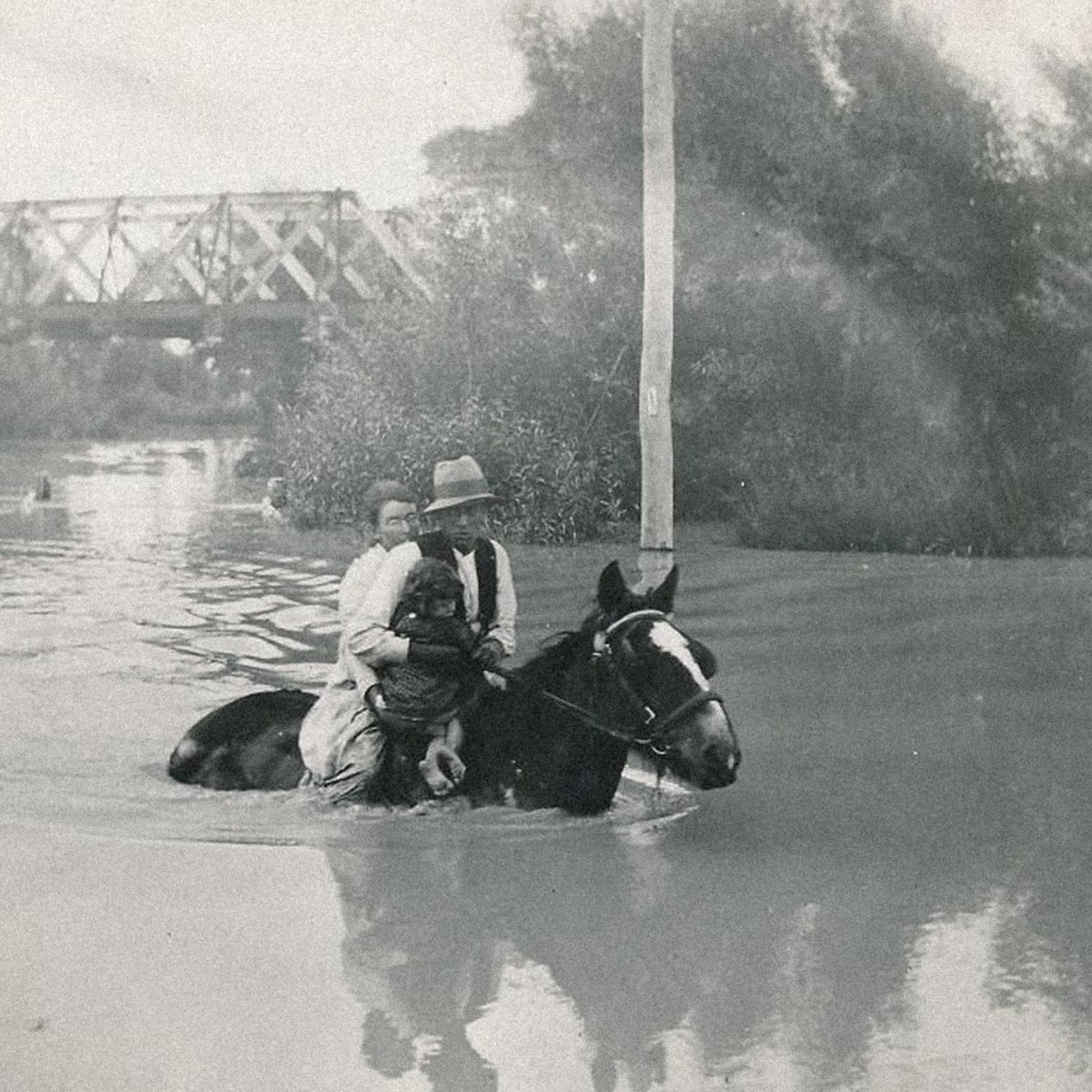
Sepia photograph of a family on horseback wading through deep floodwater, with a bridge in the background.

Two years ago our District experienced the worst flooding in living memory, closely rivalled only by the April 1951 Canterbury flood event. Severe floods have occurred with moderate frequency in the past, including the February 1936 flood event, but these were not quite on this level in terms of sheer flow. On 28 May 2021, MetService issued a red alert for Canterbury, having forecasted 200-300mm of rain in the high country. Two days later, a state of emergency was declared due to the sheer volume and duration of rainfall across Canterbury. 19 river flow recorders owned by Environment Canterbury were destroyed or damaged as the rivers reached record levels. ECan reported that their rain gauge in Mt Somers had recorded its highest 48-hour rainfall ever, at 526mm. According to the Ashburton District Council, the damage to our local roads cost $4 million to repair over six months and uninsurable damage to properties totalled $14 million. Numerous farms and buildings were wrecked, roads were washed out and bridges were battered, including the bridge between Ashburton and Tinwald on State Highway 1. The closure of our town bridge made national headlines and the South Island was essentially cut in half for days. I am sure most local readers will remember the headache that caused! It is expected that climate change will increase the intensity and frequency of extreme weather events like the 2021 Canterbury floods. However, extreme flooding typically occurs anyway once every two hundred years, give or take, which seems almost correct when you examine the Great Storm of February 1868 and the floods that resulted from it. From 4 to 6 February 1868, an ex-tropical cyclone bore down on New Zealand, which resulted in extreme weather conditions and flooding across the entire country. As many as 40 people died during the event and there were 12 shipwrecks reported. Almost the entire east coast of the South Island was flooded. On 10 February 1868, a Lyttelton Times correspondent wrote about their experiences travelling through our district at the time of the infamous storm, under the title “A new chum’s experience of a day and night of the weather and rivers of New Zealand.” Rising river or sinking coach? Our anonymous writer’s account begins in Timaru on Monday, 4 February 1868. That morning, they recall being “tired with the gaieties of Timaru” where they had been “forced to vegetate for four days.” They promptly decided to move on and secured a place on a Cobb & Co. coach headed for Christchurch, aboard which they chose the box seat (next to the driver, raised in front.) The writer soon regrets this decision, as it began raining that morning and did not show any sign of stopping. “After leaving the first station, I was informed by a fellow passenger that we were then on the runs, and that we should not leave them again till we reached Christchurch. What he meant by runs, I was then at a loss to explain, unless it was a continual run of water down my neck for the remainder of the journey.” Before crossing the Rangitata our writer switched places with the aforementioned passenger to sit further back within the coach, but they still found themselves experiencing “by no means an agreeable shower-bath.” While crossing the Rangitata River, the coachman quietly observed that he thought the river was rising, but the writer naively thought the coach was sinking while it plowed through the river. “After this came a long, miserable, dreary wet ride for 18 miles” until the party reached the Hakatere/Ashburton River. “Here, as I thought, my sorrows for the time were over, but alas! In attempting to cross with the pioneers, the coach actually stuck, and began settling so fast that at last the water was up to our waists. We were told we must jump for it, and that quickly, into about six feet of water, with the pleasing reminder that if we jumped a yard wrong, we should feel the full force of a New Zealand current. “Thankfully, all aboard made the jump safely “with only a thorough wetting.” After negotiating another channel on horseback and running through the remainder of the river, they made it to William Turton’s Ashburton Arms accommodation house intact. However, after rummaging through their luggage for a change of clothes, our writer found to their horror that all their belongings were soaked. The coachman drove off without waiting for them, and they were left behind at the accommodation house. “After borrowing a change from the obliging landlord, and getting a good dinner, things assured a much brighter aspect; still the wind kept howling frightfully, and the river was rising, though no thought of real danger occurred to anyone.” Refuge in the Arms of Ashburton The writer went to bed at 10 o’clock that night, expecting a restful night’s sleep, but two hours later they were told to get up immediately as “the river was still rising fast and was, in fact, at full flood.” They go on to describe the following events: “The water was within a few inches of the door. At this time a faint cry was heard, and some men returned, having to wade some distance up to their shoulders, with a woman and a baby, and it was known that the house was flooded, and would probably be carried away immediately. Still the water kept rising, rising, fast; and, after measuring, we found it within an inch of rushing in the house; in fact, it had commenced to flow under one of the doors.” “The agony of the poor people coming in at this time was indescribable; most of them had seen pigs, crops, poultry, sheep, and, in some instances, horses washed away, and their houses nearly floating before they quitted them. Through what can be called only the mercy of God the wind changed, and, as it was ascertained the following morning, the river had broken into a creek, which seemed to carry away a deal of the water.” In closing their correspondence with the Lyttelton Times, our dear writer says “Had it not been for this intervention of Divine Providence I should probably not be alive to write this, my first, and I can assure you I fervently hope my last, experience of the freaks and vagaries of the New Zealand rivers.” Overall, the Great Storm of 1868 and the resulting floods caused between £500,000 and £1 million in damage across the country (roughly $20-50 million today, adjusted for inflation.) Unless otherwise stated, photographs and research materials on this page are owned by the Ashburton Museum & Historical Society Inc. This post was modified for this blog and was originally published in the Ashburton Guardian, 4 June 2022.

Continue Reading

Early Urban Ashburton

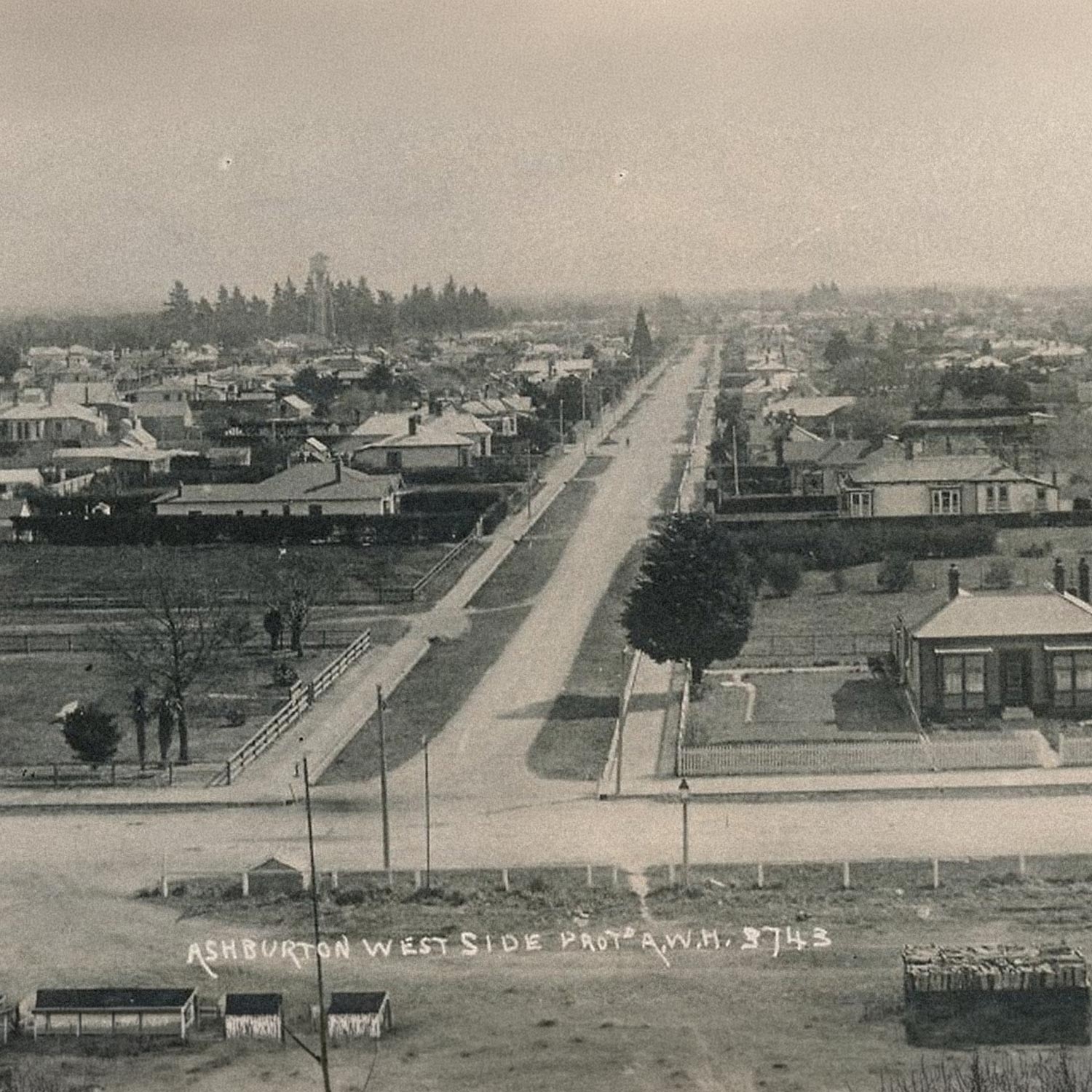
Early postcard view over Ashburton looking along Cameron Street, a wide road lined with houses and trees.

Ashburton as we know it has been constantly evolving ever since the construction of William Turton’s first accommodation house along the Hakatere Ashburton River in 1858. Rural has become urban, paddocks have become suburbs and buildings have been built, moved, modified and demolished. Ashburton was first surveyed by Robert Park in 1863 and from there our town began to grow. Generally speaking, urban Ashburton spread from the vicinity of Mona Square, northwards along East Street, and outwards along the side streets. Shops, offices, grain stores, agents and auctioneers quickly populated our fledgling central business district faster than you could say ‘Ashburton Borough Council’. Before we were even considered a borough, considerable growth had occurred. In 1903, a volume of the Cyclopedia of New Zealand covering the Canterbury Provincial District was published, which included an extensive section about Ashburton. Let’s take a look at how Ashburton was faring as a burgeoning town just after the turn of the century and see if we can draw any parallels between our past and our present. Before we dive into the cyclopedia however, let’s consider the importance of this land before Pākehā settlement and its significance for takata whenua. Our shared past Before towns and suburbs, this little slice of Aotearoa was more than capable of supporting growth and livelihood. Māori were the first to know the land that later came to be known as Ashburton District. This area contained a wide range of natural resources that were sustainably managed and collected, including seasonal foods and stone materials. Travel routes through the region were deliberately punctuated by stopping points which were in the vicinity of such resources, as well as water and shelter. Prosperity for takata whenua in this area and across Te Waipounamu (the South Island) relied on the important matauraka (knowledge) of mahika kai, the concept of valuing the natural resources that sustain life. Early urban landscape Ashburton in 1903 was described as having “the appearance of a healthy, prosperous, inland town, and that it is the centre of a rich agricultural district can be seen by glance at the large grain stores situated in the neighbourhood of the railway. The public buildings, and many of the business premises, are handsome and imposing, and the wide and well-formed streets, on market day especially, present a very busy aspect.” “The town is well built, and the streets and houses lighted with gas. With an ample supply of water always flowing in the side channels, the sanitary arrangements are excellent, and Ashburton is one of the healthiest places in New Zealand. The local industries comprise a woollen factory, flour mills, a brewery, and the Fairfield freezing works.” As for Ashburton’s population at the time, the cyclopedia states that “the recorded population of the borough, within the statutory boundaries, 2,322, does not represent the actual number of residents in the business centre of the district; if the immediate suburbs of Hampstead and Allenton were included, it would amount to at least 5,000.” Unless otherwise stated, photographs and research materials on this page are owned by the Ashburton Museum & Historical Society Inc. This post was modified for this blog and was originally published in the Ashburton Guardian, 12 March 2022.

Continue Reading

The Components of the Humble Kiwi Villa

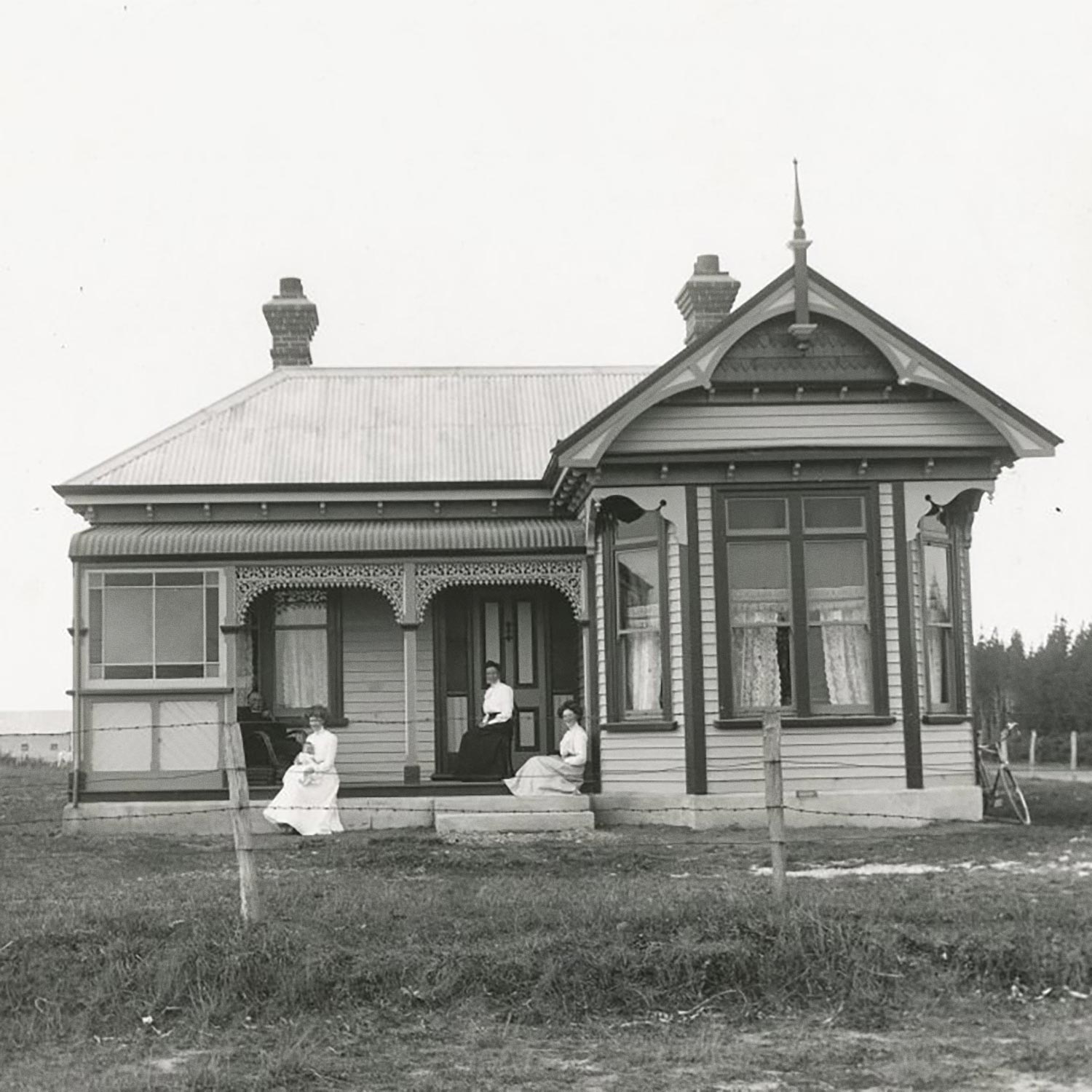
Historic photograph of a family sitting on the veranda of a rural villa in the Ashburton District.

Throughout the closing decades of the nineteenth century, New Zealand was undergoing rapid population growth and huge urban development. Factors such as improved transportation and an influx of steam-powered woodworking equipment gave rise to a new kind of house: the iconic villa. From the 1860s until the end of the First World War, villas were a very popular option for new builds. These bigger, more expensive homes were an iteration on the classic cottages which were so widespread in the preceding years. Construction Villas were constructed almost entirely of native timber, including fixtures and fittings, with a metal roof. There were exceptions to the rule. For example, there is a bay villa on Wakanui Road, designed by Ashburton architect Harry E. Vincent, which was built using bricks from Crum’s brickworks instead of being of typical weatherboard construction. Thanks to advances in machine moulding and woodworking, many villas bore ornate features and ornamentation. These new accoutrements would have been out of the price range for many people just decades before the villa’s rise in popularity. Some of these houses were architect-designed, like the brick villa, while many others were built from pre-prepared plans. The customer would choose their desired floorplan and accessories from a catalogue. As suburbs developed many of the villas seen dotting the streets were built in this fashion. Two-storey villas were also not unheard of. In Jeremy Salmond’s Old New Zealand Houses 1800-1940 it is noted that different features were more common in different regions: bigger verandas in Auckland, cast iron fretwork in Dunedin and narrower two-storeyed designs were preferred in Wellington. Form and function The concept of separating public and private spaces within the home was a central feature of the villa. A villa’s central hallway would usually be cut in two by an ornate archway, which marks the dividing line between the public and private parts of the house. The parlour, or formal sitting room was used to receive and entertain guests (not for everyday leisure) and so it was at the front of the house, while the kitchen and bathroom were at the rear. The best furniture and family treasures were often found in the parlour, where they would be seen and enjoyed by visitors. The reasoning behind the parlour being at the front of the villa may have originated from earlier cottages, in which the closest room to the front door was the sitting room, or the front door opened into the sitting room which acted as a thoroughfare. One of the most striking features of any villa is the bay window, which would typically protrude from the parlour room, facing the street. Walking through the hallway, you would find a couple of bedrooms branching off the long main hallway before you reach rooms such as the kitchen, scullery and pantry. Larger bay villas would have squeezed in another bedroom, bathroom and laundry. Of course, you can’t forget the front veranda; an enticing perch upon which families would sit and enjoy the fresh air. Today we still see it as a prime spot for some outdoor furniture (an old crusty couch will do in a pinch.) A kiwi icon Villas are unmistakably, undoubtedly Kiwi. Each one is a slice of social history, a residential landmark, almost. On many streets throughout Ashburton you will find at least one, or several villas with families or flatmates living in them. With a bit of care and insulation they quite often make great homes despite being what you could say to be a hundred years past their prime. Unless otherwise stated, photographs and research materials on this page are owned by the Ashburton Museum & Historical Society Inc. This post was modified for this blog and was originally published in the Ashburton Guardian, 25 September 2021.

Continue Reading

Tinwald: Southern suburb or more than meets the eye?

Sepia photograph of men in boater hats and a woman with a parasol relaxing on the grass beneath willow trees in the Tinwald Domain.

Tinwald! Is it just a suburb, Ashburton’s little sibling or is it something much more? While the typical traveller passing through town along State Highway 1 might see Tinwald and Ashburton as one big place split in two by the river, us locals know that isn’t the case… There’s something different about Tinwald. In the early days of European settlement, those living on the south side had it a bit harder than their neighbours to the north, which drove forth a sense of pride and independence that still endures today. To illustrate what life was like in early Tinwald and the changes that came over time, let’s take a look at some of the early history as written by Emily Bayliss in her 1970 book Tinwald: A Canterbury Plains Settlement. Life on the south side According to the Ashburton Guardian, an early visitor to Tinwald in 1878 spoke of the township as being “one of those progressive and irrepressible little centres of inland commerce that, springing up in all directions, show[s] the energy and thriving industry of New Zealand settlers, and this is known as the town of Tinwald.” This visitor went on to describe the forthcoming erection of a school and master’s residence, a future church designed by Mr Mountford of Christchurch and plans for the Tinwald Domain. Early traders in Tinwald included grocers, bakers, storekeepers, bootmakers and more. One particular early resident who wore many hats was Thomas Williams: he was a builder, undertaker, cabinetmaker and wheelwright! A mere couple decades prior, instead of a bustling township this unknown visitor would have laid eyes on a flat and swampy expanse, home not to overworked carpenters but instead to thick growths of harakeke/flax. What would become the Ashburton District was once an important section of the Eastern Coastal Trail of Te Waipounamu which was extensively travelled-through and settled by takata whenua. Kāika nohoaka (settlements) and kāika mahika kai (food-gathering sites) dotted the east coast along this important ara tawhito (traditional travel route). Before Tinwald township was laid out, early European settlers used the area as a hunting spot. People from Turton’s Accommodation House in early Ashburton would cross the river to bag wild pigs, ducks and pukeko. Tinwald rose from that swamp and became famous in its own right: John Carter’s Grove Farm and its respectable pedigree of racehorses managed by Edward Gates made headlines and earned Tinwald some kudos in sporting circles. Like Ashburton, farming has been the lifeblood of Tinwald. The Tinwald saleyards were especially important and only closed in 2016, which marked the end of its 138-year run of massive stock sales. Another point of fame for Tinwald is the Domain. The first steps toward laying it out were taken in 1881 and since then it has been praised non-stop for its quality as a grounds for recreation and relaxation. Domestic doldrums… or not? Life in early Tinwald was a mixed bag. Times were tough, but people pulled together and found happiness in each other’s company. Until its amalgamation with the Ashburton Borough in 1955, Tinwald was described as a “self-contained community” and according to Emily Bayliss in her book on Tinwald, the locality was “settled by a working class people, who depended for their subsistence mainly on the surrounding farming country.” The keyword here is subsistence, since “most of the first settlers had very little financial backing” and many could barely afford the rent for their small cottages. In the early days before 1880 there was no Hospital and Charitable Aid Board to dole out relief in the case of sickness or injury. Instead of relying on such assistance, people relied on each other, “the poor helped the poor.” Life was a bit on the rough side for most, but how about the well-to-do? In some cases, a few wealthier residents chose to affiliate themselves with Ashburton rather than be associated with Tinwald. Talk about snobbish, since many people are proud of Tinwald these days and it just goes to show how opinions can change over time. Tinwald today There was once a time when the majority of Tinwald’s residents were older folk of the long-standing variety, who could remember many events and changes around the township vividly; they are still around of course, but due to rapid growth they are now a minority among the great numbers of young families and workers that now live in Tinwald. The little township has changed a lot, but some things have stayed the same: the community spirit and pride sets Tinwald apart from the rest. Emily Bayliss wrote that “in times past the closeness of Ashburton to Tinwald worked to the disadvantage of the latter. Added to that was a feeling that the township was looked on with condescension by its opposite number across the river. However, an inferiority complex never developed. In the words of that unknown visitor in 1878, this ‘irrepressible little centre’ has gone on its friendly, united way to progress.” Unless otherwise stated, photographs and research materials on this page are owned by the Ashburton Museum & Historical Society Inc. This post was modified for this blog and was originally published in the Ashburton Guardian, 11 September 2021.

Continue Reading

Waterton: a township lost to time

The Waterton Hotel

When you come across the scant remains of a place like Waterton, you start to wonder what led to such a fate. The old cemetery on Grahams Road is the last inkling of this once a popular township, which fell prey to issues caused by a need for labourers elsewhere, as well as that classic problem for many rural villages: the railroad did not pass through Waterton. Before the decline Waterton experienced an exciting boom period and was once described as a “favourite health resort” by the 1903 Cyclopedia of New Zealand. As was the case with the village of Barrhill, it all started because of a need for labourers’ housing. Waterton was born out of necessity to accommodate many employees of the Longbeach Estate. In a nutshell, it was labour requirements that gave birth to Waterton Township, and a lack thereof that caused its recession into obscurity. A town is born Waterton was surveyed by Francis Pavitt in 1876. The intended scale was extensive – a central town belt surrounded by town streets and quarter-acre residential sections. William Tuckett Norrish and his family were the first arrivals and they built a home and set up a blacksmith’s shop. Land was sold on Saturday, 22nd of April 1876 which included 139 quarter-acre sections, as well as 10 and 20 acre blocks totalling 6,000 acres. The initial advertisement in the Lyttelton Times mentioned that the blacksmith’s was already up and running, and that there were Government schools close by, daily coaches from Ashburton to Longbeach and Reserves for a church and library. The pitch sounded ideal… and it worked. Bidding was “brisk” according to the initial sale report and less than two years later in March 1878 the Ashburton Mail reported that “at Waterton there are signs of a township. There is a general store, butcher, baker, a general blacksmith and a saddler. Tenders are called for the erection of another store and the new Church of England is to be commenced next week. We have been shown the plans of a neat country hotel”. Before the end of the year, progress had accelerated at an astonishing rate and it seemed that nothing could stop Waterton’s growth. Heyday In the later years of the nineteenth century Waterton boasted a good number of services and facilities. The crown jewel of Waterton was the hotel, which the 1903 Cyclopedia of New Zealand described as having “24 rooms including the dining room and four sitting rooms. A balcony runs round the house affording on the one side, a splendid view of the sea and on the other, of the picturesque neighbouring country, with the hills in the distance. Waterton is a favoured health resort. The house throughout is a model of cleanliness. A good table is also kept. Stabling is provided and there are accommodation paddocks for sheep.” Despite periodic closures due to licensing issues, the Waterton Hotel was a great asset to the township. The Waterton Store was also important since it sold groceries, confectionery, materials, clothing, hardware and footwear. It was without a doubt an essential service for this once-burgeoning rural community which boasted a population of 235 people at its peak. Concerts and balls were common at the hall, which used to be the library. Aside from regular gatherings there were numerous special events which included a dance to celebrate the electrification of Waterton in 1925, a concert involving the new ‘wireless’ radio in 1926 and other entertainments. Magic lantern shows in the 1920s, silent movie screenings with piano accompaniment and talkies were shown later on by Len Colville before “pressure from outside stopped them being shown.” Improved means of transport allowed Waterton locals to access the Ashburton Public Library, which led to the closure of the library in 1941, but it continued to be used as a hall until its final closure in November 1974. The slow decline of Waterton eventuated in the sections that made up the township and surrounds being turned into lifestyle blocks in the early 2000s. Waterton cemetery The main bulk of what was once Watertown Township was on either side of Russells Road where it joins Grahams Road. The cemetery at Waterton is the last remnant of that community in situ, situated just down the road on the East side of where the township once was. The first interment was that of James Leyton in May 1881, a month before the Waterton Cemetery Board had even erected a fence or front gate. The cemetery is still open for burials to this day and last year marked 140 years since the first burial there. Not only is the Waterton Cemetery a symbol of what once was, but it is still an important place for current residents and represents the enduring identity of the area. However, the cemetery is not the final legacy of Waterton. The Church of St Philip and St James, which once served the Waterton community for a very long time, was moved to the site of The Plains Vintage Railway & Historical Museum at the Tinwald Domain in 1976 and is expertly well cared for; a happy ending for a building that is still dear to many people. Special thanks Research for this story came mainly from the fantastic and authoritative book “Miles of Tiles Revisited: A Journey through Longbeach and Surrounding Districts History” which was compiled and written by the late Gilmour Blee. Unless otherwise stated, photographs and research materials on this page are owned by the Ashburton Museum & Historical Society Inc. This post was modified for this blog and was originally published in the Ashburton Guardian, 3 August 2021.

Continue Reading

Quick history of Barrhill: J C Wason’s model village

Black-and-white photograph of a large group of parents and schoolchildren posed in rows outside Barrhill School for a flag-hoisting ceremony in 1901.

What remains of the quaint model village of Barrhill is undeniably unique, the few original buildings standing as a reminder of what was once a thriving settlement and a dream-come-true. Barrhill was laid out in the 1870s by John Cathcart Wason, owner of the Corwar Estate, to accommodate his workers and their families. Designed to serve a small yet prosperous community, Barrhill enjoyed a period of stability before declining after Wason sold up in 1900. As quickly as Barrhill rose from nothing, the settlement’s population shrank and Wason’s dream died out. The closure of the school in 1938 was the final nail in the coffin. The birth of Barrhill John Wason, who was described as a “massive” man of six foot six, took up 20,000 acres by the Rakaia and renamed the run to Corwar, previously known as Lendon. The name Corwar came from his previous home in Ayrshire, Scotland. After managing to transform the run from a tussock-ridden wasteland into arable land, he made a large portion of it freehold and eventually the whole of Corwar was purchased by 1878. Wason was a keen planter, and his passion for trees led him to develop vast plantations that were visible across the Rakaia for miles as early as 1885. He built a homestead of 20 rooms, surrounded by rare trees and complete with modern outbuildings, a lodge, and gate-keeper. Wason was becoming more successful by the minute, yet he was seemingly unsatisfied with his progress. A belief he brought from Scotland was that all farmworkers should own their own homes, and so he envisioned a dedicated village to serve Corwar and house its staff. This was to be Barrhill. Perfect by design Barrhill was meticulously designed not only to serve a practical purpose but also to reflect certain sentimentalities and beliefs held by J C Wason. The plan for Barrhill was drawn up by Charles F Barker and is dated the 24th of March 1877. There were 28 sections for sale, and 4 large sections bordering the central square were set aside for the church, vicarage and school. Spirituality lay at the heart of the village as evidenced by the nearly 145-year-old church of St John the Evangelist that still stands right in the middle of the settlement. Trees featured heavily in Barrhill’s design, which is still known today for its tree-lined avenues. Birches were planted along the east avenue, oaks on the west and the market square was planted with both elms and oaks. It took until 1975 for the full extent of Wason’s planning to be noticed. It was in that year that Bill Irwin took an aerial photograph of Barrhill which showed the trees forming three circles which are assumed to represent the Holy Trinity with the church at the middle. Regardless of whatever angle you view it from, it is clear that the village of Barrhill was crafted by Wason with keen attention to detail and strong purpose, The rise and fall The first house plot at Barrhill was bought on the 5th of December 1877 by hotelkeeper George Rimer, and so a hotel was one of the first structures in the village. The Barrhill school opened its doors on the 7th of June 1878 with 23 pupils on the first roll. Barrhill prospered from the outset as sections were filled up by, predictably, labourers, farmers, and various workers and their families. The village settlers were not all just farm workers; there was Auguste Joen the blacksmith on Lot 6, James Bishop the baker on Lot 8 and Christopher Hammond the gardener on Lot 28, to give a few examples of exceptions. Before the freezing works were built at Fairton, Barrhill was even the site of a mutton boiling-down works which processed up to 100 sheep a day. Prices for sections varied, presumably due to locations and when the sections were bought; however it is still hard to initially fathom why William Radford had paid £125 for Lot 13 in 1878, whereas John Spring paid just £5 for Lot 24 in 1901. This may be to do with the fact that villagers were leaving as early as 1886, due to the depression and the gradual sale of Corwar. On top of this, the railway from Rakaia to Methven bypassed Barrhill in favour of Lauriston, which took a further toll on the area. Remnants, not ruins Barrhill school eventually closed and consolidated with Lauriston school 10 kilometres away in 1938 and the Barrhill area gradually reverted to farmland with just a few houses remaining alongside the church, the old school building and some other lasting features of a failed dream. The gatekeeper’s lodge at the entrance to Corwar, which is now a fascinating small museum, is another good example of Wason’s distinctive style and is furnished to appear as if it is frozen in time. Barrhill is also home to a historic cemetery, squashed tightly between two paddocks on a long, thin, grassy section. The few graves that adorn the far end of the cemetery are a reminder of what once was, and the fact that so much of the section is empty, unfinished and unassuming, speaks for itself. Photographs and research materials on this page are owned by the Ashburton Museum & Historical Society Inc. This post was modified for this blog and was originally published in the Ashburton Guardian, 12 June 2021.

Continue Reading

True Crime: Rakaia

Postcard portrait of Amy Bock dressed in men’s clothing, standing in a long overcoat with a high collar.

Ever since I started writing for the Guardian and this blog, I have found myself gravitating towards the odd and unusual. If you have followed us for a while, you will remember several articles about odd photos, weird crimes and unusual occurrences involving some very unique personalities. Many of the lives we’ve talked about have been admirable ones, however I have also touched on the lives of some less-than-savoury eccentrics such as the falsely qualified phrenologist Lio Medo, the Domain tree thieves Thomas Nolan and Jeremiah Hefferman, and more. Ashburton’s past contains a veritable rogue’s gallery of foolish petty criminals. While undertaking some basic research, I was skimming through “Rakaia: Our History” by Janine Irvine and the Rakaia History Group and came across the section on the Rakaia police station, the old jail and the courthouse. As you can imagine, I caught the criminal bug once again and I decided to base this week’s post on… yet more historic criminals and cases from our own backyard. Amy Bock: gold digger extraordinaire The exploits of the infamous Amy Bock as described in the Rakaia book are nothing short of amazing. Amy was an experienced con artist. Newspaper reports from across the country predating her arrival in Rakaia paint her as a cunning, uncaring and kleptomaniacal woman with a penchant for fraud. Having come to Rakaia in 1904, the charismatic “Amy Chanel” soon weaseled her way into a cosy job as John Gardiner’s housekeeper. Unbeknownst to everyone, she had only just been released from jail in Christchurch. John gave Amy a cheque for two pounds which was to pay an account in town, which she changed to twelve pounds and handed off to a man whom she asked to purchase goods for her. According to the Guardian, he did this and then gave her the goods and the change which she pocketed. Amy tried to blame the forgery on the man who helped her, but none were convinced and she copped a three year prison sentence, given her history. After her release, she continued to target unsuspecting men across Canterbury until she settled on an exciting new alias – that of a wealthy farmer named Percy Leonard Redwood. Amy posed as Percy for some time and seemed to really have gotten into character. She travelled to South Otago and caught the eye of Agnes Ottaway, a wealthy spinster. “Percy” led Agnes on and they were wed in April 1909, but Amy could not keep the act up for much longer. Bad debts and suspicion eventually culminated in her arrest, leaving poor old Agnes to feel terribly embarrassed about the false marriage. Amy reportedly continued to swindle her way through life until her death near Auckland in 1943 at a ripe old age. A more serious case The shocking case of Thomas Dalziel’s murder stands in contrast to the relatively light-hearted antics of Amy Bock. In 1887, a widow by the name of Martha Dalziel, who was suffering from alcohol abuse and some mental health problems, tried to drown herself and her son in the Rakaia following the death of her husband Tom. She worked as a housekeeper at the Dunsandel Hotel until she was asked to leave on account of her alcoholism, and after missing the train to Rakaia she was last seen walking there with her boy. John Leebody, bridgekeeper, saw her carrying her son across the bridge at midday before she stopped in at the South Rakaia hotel for a few drinks. She then headed off and was spotted by Catherine Thompson walking across the paddocks. Catherine got her brother to come with her as she watched Martha head down to the water, and to their horror they witnessed Martha tie her son to herself and plunged into the water. Help was called for, and a local boy found them further downstream; the child had drowned but Martha survived and was sent to Christchurch and tried for her son’s murder. The story of Martha and Thomas Dalziel is definitely one of the more sinister cases to come out of Rakaia, and while she reportedly loved her son very much she was suffering from a potent combination of sorrow and alcoholism that resulted in tragedy. Setting an example To finish on a lighter note, here is an amusing anecdote told by Eric Johnston in the Rakaia book reads as follows: “The last Court I can remember, or anybody being in it, was a joker from Bankside. He was caught in the pub after hours or something, so the Constable decided to make a big case from this and set an example of this poor guy. They brought someone to represent him at the Court and they put the Constable in the box to give evidence. The defendant interviewed the Constable and asked, “Have you broadcast this around the town and discussed this case with two or three of your cobbers around the town Sir?” knowing full well the town was talking about the case. He had to answer yes so the case was dismissed! The Constable pulled on his hat and as he got out the door his hat knocked off and the whole court laughed-it was one hell of a joke!” “Rakaia: Our History” is available for research by appointment at the Ashburton Museum. This post was modified for this blog and was originally published in the Ashburton Guardian, 31 October 2020.

Continue Reading

The Space Balls: When Cosmic Junk Landed in Mid Canterbury

Black-and-white photograph of a DSIR scientist in a white coat examining the burnt-out hole in the first space ball.

I am sure that many of you who are familiar with some of the Ashburton District’s weirder occurrences have rolled your eyes by now. It has been a while since a full-blown story has been published on the space balls, but I am sure that a lot of you will not need reminding of these strange events. For the uninitiated, the space balls are a set of mysterious metal balls that fell from the heavens above Mid Canterbury, and landed in paddocks across the Ashburton District. Looking back on newspaper articles from the seventies and the decades following, it is very interesting to see the contemporary theories surrounding these mysterious metal orbs, and the explanation is surprising – although obvious. The spheres appear The story of the space balls begins in 1972, with local farmers discovering odd objects in their paddocks across the Ashburton District. On April 3rd 1972, a brilliant light was seen crossing the sky above Manapouri at 1 am, and was observed fragmenting into 15 – 20 “pieces” above Queenstown before travelling over Lake Aviemore. The meteor-like anomaly flared and disappeared for a moment, before five distinct tracks of light reappeared and were last seen over Ashburton. Later that same day, John Lindores of Huntingdon discovered a large metal ball on his property, 200m from his home. According to a Guardian retrospective on these events by Annie Studholme, the puzzled Mr Lindores ended up calling the police. Sergeant John Wheeler came to investigate and determined that the object had been “dropped from a considerable height.” The orb weighed 13.6 kilograms, was 380mm in diameter, and had an unusual burnt-out hole on one side, the edges of which seemed to have been warped and bent back as if the ball had been exposed to extreme heat. On the other side of the ball, a protruding ring with a small hole stuck out from the surface of this mysterious object, which was clearly welded together from two halves. Sergeant Wheeler contacted the technical staff from the Royal NZ Air Force as well as the US Navy. The next day, Captain Boucher of the US Air Force tracking station at Mount John, Lake Tekapo, came to examine the ‘space ball’ as it was now known. The only thing he could determine for sure was that it was “only a small piece of a large object.” Its origins could not be clearly determined, and so as a precaution the space ball was left covered in a cell at the Ashburton police station in case it proved to be radioactive. More balls make a landing Eventually, the National Radiation Laboratory of Scientific and Industrial Research in Christchurch revealed that the space ball was not radioactive, before the object was sent up to the DSIR in Wellington. The DSIR found that it was made of a titanium-based alloy, common in the construction of air and spacecraft. Not long after the first ball’s arrival, another showed up on Gavin Thomson’s farm at Hinds, and then another in North Otago, followed by two more – one at Lynnford and another one near Hinds. While all this was happening, both the United States and the Soviet Union denied responsibility for the space balls which had now enthralled the collective imaginations of Mid Canterbury. Later in 1972, the Hinds Gymkhana Club tried to secure the space balls for a display at their annual Labour Day gymkhana, but were denied this by the Minister of Foreign Affairs Sir Keith Holyoake. After this spate of findings, things calmed down and the space balls were not mentioned much in the years following the phenomena. Six years later in 1978, another space ball made a landing in one of John Lovett’s paddocks at Eiffelton, and the same procedure was followed as with the last space balls – it was sent off to be tested for radiation, and this test came back negative. Another ball was found too, but these later incidents were debunked and these copycat balls were found to have been modified sea floats, which were burnt with a blowtorch to give the impression of having entered the Earth’s atmosphere. Real or hoax? Naturally, some speculated that the space balls were an elaborate hoax – one which we might compare today to the mystery of the shiny metal monoliths that are still appearing in odd places around the world. However, the idea of the balls being a hoax was discounted by the fact that the alloy that comprised the space balls was very expensive and hard to manufacture. As mentioned before, the US nor the USSR would claim responsibility for the space balls, but speculation pointed towards the most likely origin for the space balls – that they were in fact spacecraft parts. It was not until 2002, when certain government documents were declassified, that the truth of the space balls could be certifiably explained. The first set of space balls came from the Soviet Venus probe Kosmos 482, which separated into four pieces in an Earth parking orbit while attempting to maneuver into a Venus transfer trajectory. Two of these pieces remained in low Earth orbit before descending on New Zealand, setting off the whole space ball phenomena. In May, 2025, the remainder of Kosmos 482 finally returned to earth, crashing into the Indian Ocean and thus closing a chapter in the history of cosmic history… This post was modified for this blog and was originally published in the Ashburton Guardian, 27 February 2021.

Continue Reading