Great Storm of 1868: Refuge in “Arms” of Ashburton
Two years ago our District experienced the worst flooding in living memory, closely rivalled only by the April 1951 Canterbury flood event. Severe floods have occurred with moderate frequency in the past, including the February 1936 flood event, but these were not quite on this level in terms of sheer flow. On 28 May 2021, MetService issued a red alert for Canterbury, having forecasted 200-300mm of rain in the high country. Two days later, a state of emergency was declared due to the sheer volume and duration of rainfall across Canterbury. 19 river flow recorders owned by Environment Canterbury were destroyed or damaged as the rivers reached record levels. ECan reported that their rain gauge in Mt Somers had recorded its highest 48-hour rainfall ever, at 526mm.

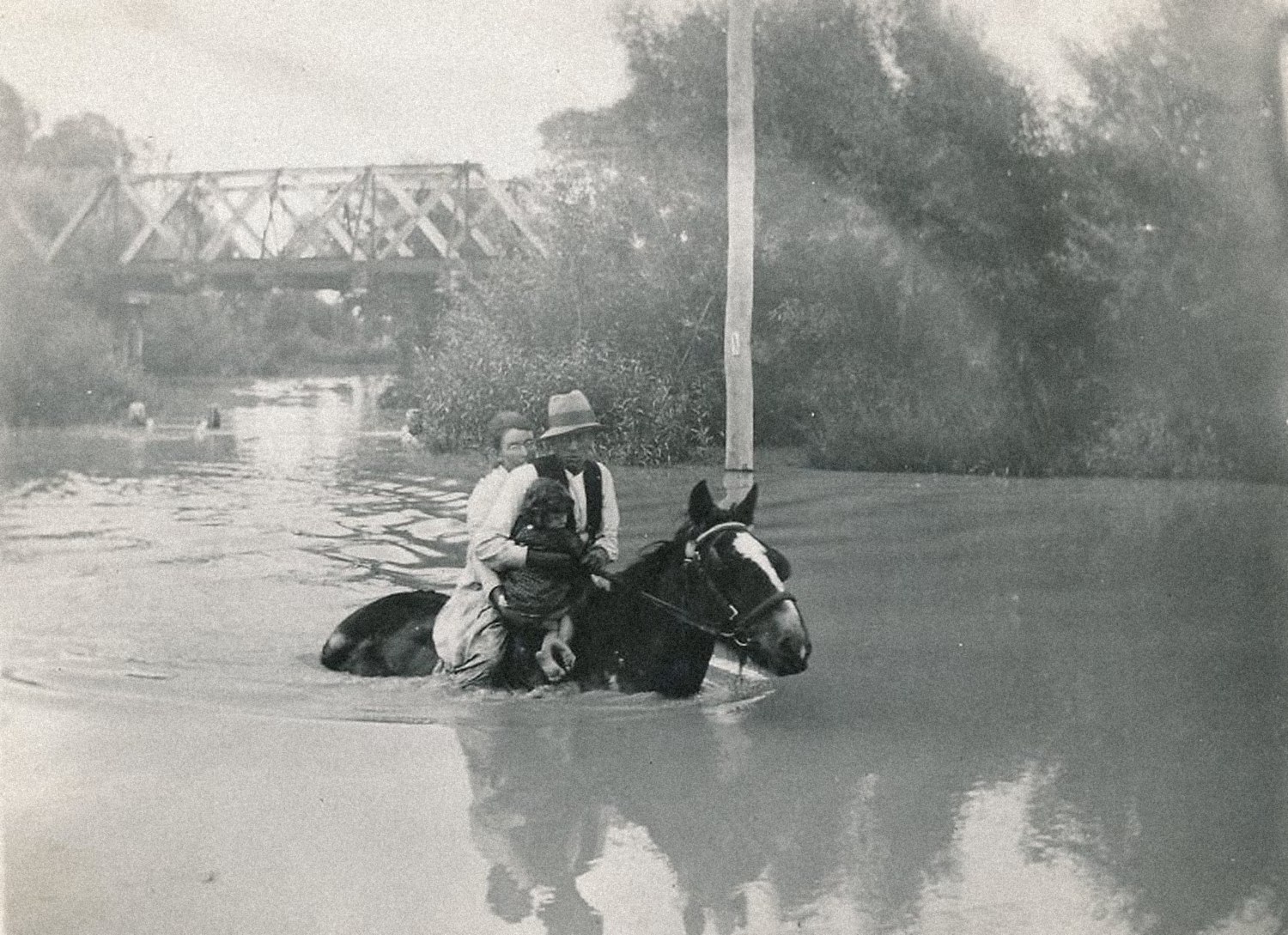
According to the Ashburton District Council, the damage to our local roads cost $4 million to repair over six months and uninsurable damage to properties totalled $14 million. Numerous farms and buildings were wrecked, roads were washed out and bridges were battered, including the bridge between Ashburton and Tinwald on State Highway 1. The closure of our town bridge made national headlines and the South Island was essentially cut in half for days. I am sure most local readers will remember the headache that caused!
It is expected that climate change will increase the intensity and frequency of extreme weather events like the 2021 Canterbury floods. However, extreme flooding typically occurs anyway once every two hundred years, give or take, which seems almost correct when you examine the Great Storm of February 1868 and the floods that resulted from it.
From 4 to 6 February 1868, an ex-tropical cyclone bore down on New Zealand, which resulted in extreme weather conditions and flooding across the entire country. As many as 40 people died during the event and there were 12 shipwrecks reported. Almost the entire east coast of the South Island was flooded.
On 10 February 1868, a Lyttelton Times correspondent wrote about their experiences travelling through our district at the time of the infamous storm, under the title “A new chum’s experience of a day and night of the weather and rivers of New Zealand.”
Rising river or sinking coach?
Our anonymous writer’s account begins in Timaru on Monday, 4 February 1868. That morning, they recall being “tired with the gaieties of Timaru” where they had been “forced to vegetate for four days.” They promptly decided to move on and secured a place on a Cobb & Co. coach headed for Christchurch, aboard which they chose the box seat (next to the driver, raised in front.) The writer soon regrets this decision, as it began raining that morning and did not show any sign of stopping. “After leaving the first station, I was informed by a fellow passenger that we were then on the runs, and that we should not leave them again till we reached Christchurch. What he meant by runs, I was then at a loss to explain, unless it was a continual run of water down my neck for the remainder of the journey.”
Before crossing the Rangitata our writer switched places with the aforementioned passenger to sit further back within the coach, but they still found themselves experiencing “by no means an agreeable shower-bath.” While crossing the Rangitata River, the coachman quietly observed that he thought the river was rising, but the writer naively thought the coach was sinking while it plowed through the river. “After this came a long, miserable, dreary wet ride for 18 miles” until the party reached the Hakatere/Ashburton River.
“Here, as I thought, my sorrows for the time were over, but alas! In attempting to cross with the pioneers, the coach actually stuck, and began settling so fast that at last the water was up to our waists. We were told we must jump for it, and that quickly, into about six feet of water, with the pleasing reminder that if we jumped a yard wrong, we should feel the full force of a New Zealand current. “Thankfully, all aboard made the jump safely “with only a thorough wetting.” After negotiating another channel on horseback and running through the remainder of the river, they made it to William Turton’s Ashburton Arms accommodation house intact.

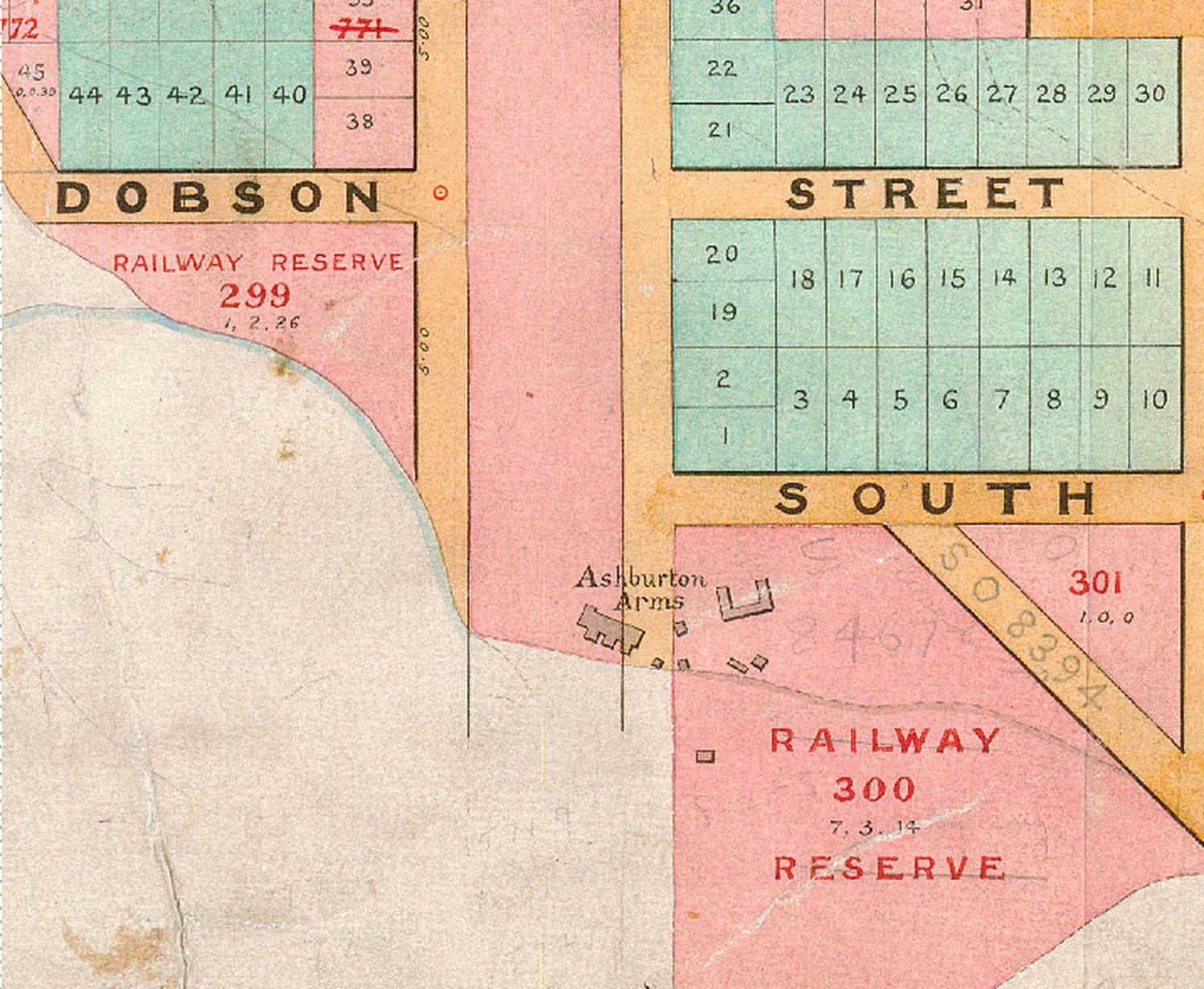
However, after rummaging through their luggage for a change of clothes, our writer found to their horror that all their belongings were soaked. The coachman drove off without waiting for them, and they were left behind at the accommodation house. “After borrowing a change from the obliging landlord, and getting a good dinner, things assured a much brighter aspect; still the wind kept howling frightfully, and the river was rising, though no thought of real danger occurred to anyone.”
Refuge in the Arms of Ashburton
The writer went to bed at 10 o’clock that night, expecting a restful night’s sleep, but two hours later they were told to get up immediately as “the river was still rising fast and was, in fact, at full flood.” They go on to describe the following events: “The water was within a few inches of the door. At this time a faint cry was heard, and some men returned, having to wade some distance up to their shoulders, with a woman and a baby, and it was known that the house was flooded, and would probably be carried away immediately. Still the water kept rising, rising, fast; and, after measuring, we found it within an inch of rushing in the house; in fact, it had commenced to flow under one of the doors.”
“The agony of the poor people coming in at this time was indescribable; most of them had seen pigs, crops, poultry, sheep, and, in some instances, horses washed away, and their houses nearly floating before they quitted them. Through what can be called only the mercy of God the wind changed, and, as it was ascertained the following morning, the river had broken into a creek, which seemed to carry away a deal of the water.”
In closing their correspondence with the Lyttelton Times, our dear writer says “Had it not been for this intervention of Divine Providence I should probably not be alive to write this, my first, and I can assure you I fervently hope my last, experience of the freaks and vagaries of the New Zealand rivers.”
Overall, the Great Storm of 1868 and the resulting floods caused between £500,000 and £1 million in damage across the country (roughly $20-50 million today, adjusted for inflation.)
Unless otherwise stated, photographs and research materials on this page are owned by the Ashburton Museum & Historical Society Inc. This post was modified for this blog and was originally published in the Ashburton Guardian, 4 June 2022.